Day 19 Exploring around the area
It had been raining. Not heavily but enough to put the water catcher out again, especially as we were staying put here today and not moving on. There was even some blue sky appearing
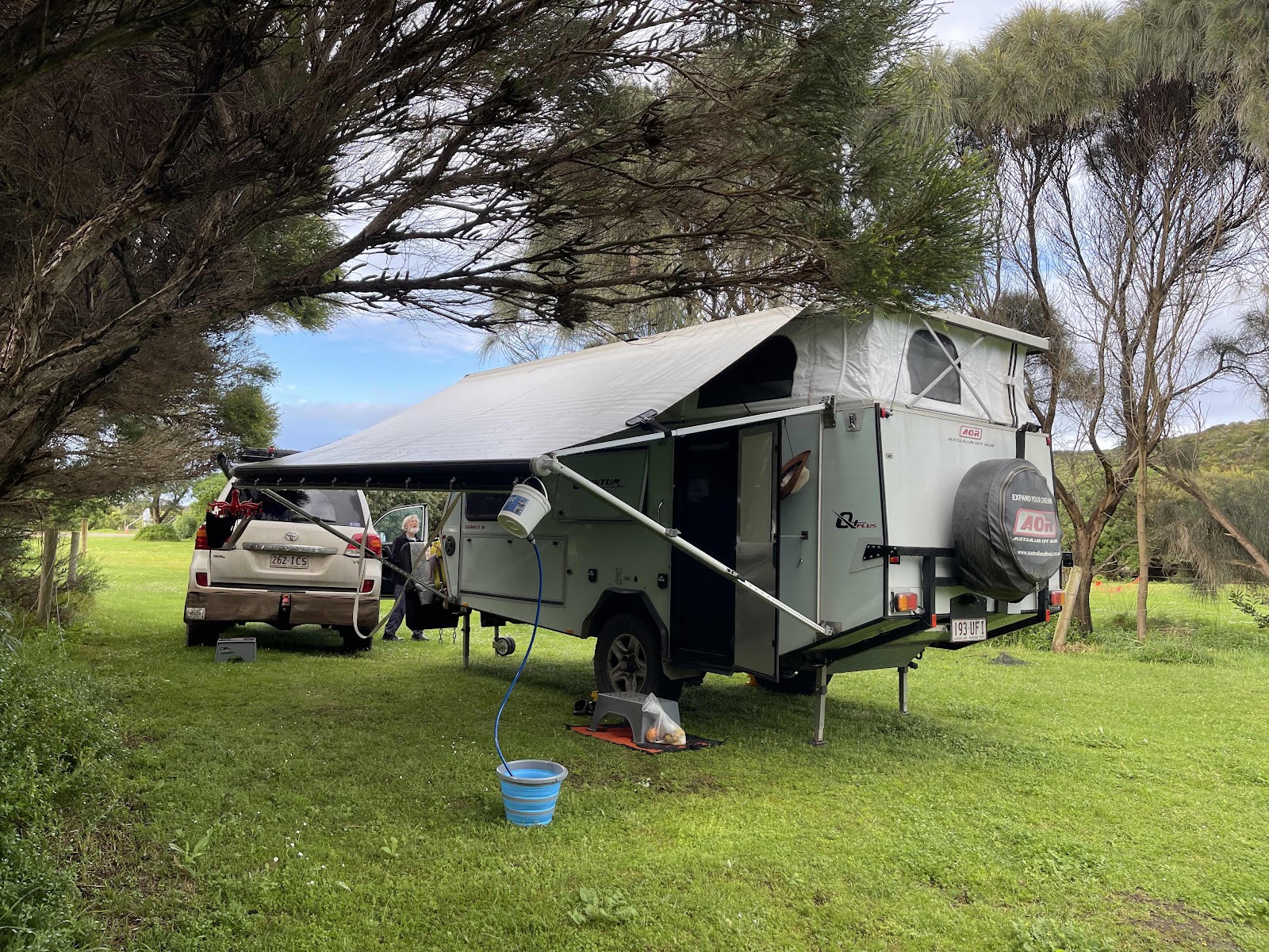
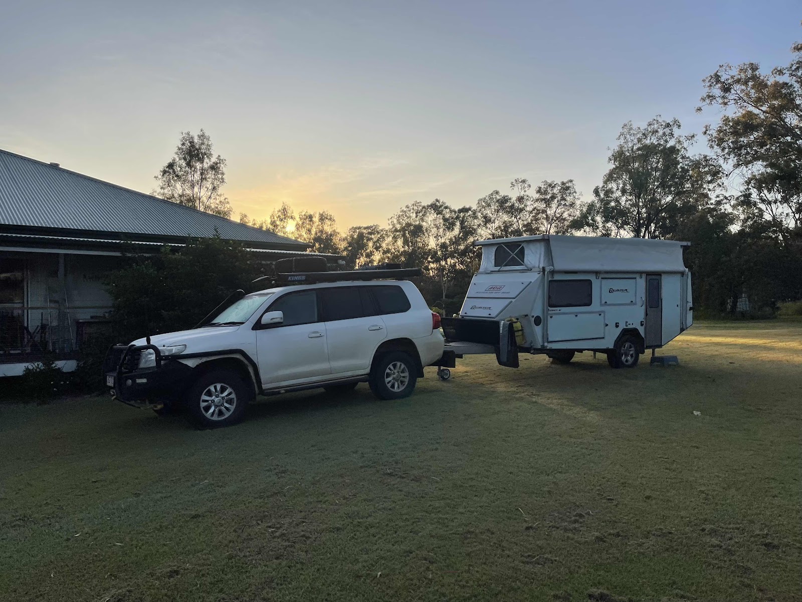
Our plan for the day was to leave the van here and go exploring from here with just the vehicle. We drove around the oval of the recreation park on the way out

Weather wasn’t looking the best to begin with

Out over the Gellibrand river

Past the little picnic area over the other side of the bridge over the river

Along the road out of the recreation reserve

Drove up into Princetown to check it out. Unfortunately everything was closed. Apparently due to COVID

I went and looked out from the lookout in the town


Across to where we are camped

Our plan for the morning was to head out to Wreck Beach
This meant driving back part the way along the GOR that we had come along yesterday.
Past where the bridge was being fixed


We came to the road that said ‘not suitable for coaches and caravans’ that we had passed yesterday
We came to the road that said ‘not suitable for coaches and caravans’ that we had passed yesterday
There was no sign on the road saying where it was going but fortunately we had the map that showed that it went to Wreck Beach.

Gravel road but certainly not too bad


Finally came to a sign with directions to Wreck Beach


First of all we decided we would go and check out the Gables

Track there a bit muddy from last nights rain

A few obstacles along the way


And the sun had started to come out by the time we had reached the lookout

Absolutely magnificent views from the lookout

With the water looking so clear because there was no flow from any rivers with agriculture activity flowing into this area


Spotted this monkey green and these pretty wildflowers on the walk back


Also took a photo of the noticeboard with the information about this area as it is spot-on

Stopped off at the Moonlight Head cemetery on the way back out from the lookout

Some interesting headstones


Surprisingly quite a few graves there, a lot of them fairly recent we had expected that it was an historic gravesite


On further checking of the graves in the graveyard it seems that this was the original plot dating back to 1906

Next we took the turn to Wreck beach

The people from this car obviously took note of the sign we saw them later walking back up the steep hill

Views out to the ocean on the road down

Reading this sign you would think that it wasn’t a long walk to the beach

However reading this noticeboard gives a clearer explanation of the path ahead

We came across this shoe cleaning station at the intersection with the great ocean walk. It is the first time we have seen one of these on any of the cross paths with the walk


So off we go down to the beach

Beautiful views on the way down


A bit of mud on the steps

Eventually got to see the beach ahead


Made it


We hadn’t checked the tide ahead of time so weren’t sure if we would even be able to walk around to the anchors

As luck would have it the tide was out
However reading this noticeboard gives a clearer explanation of the path ahead
We came across this shoe cleaning station at the intersection with the great ocean walk. It is the first time we have seen one of these on any of the cross paths with the walk
So off we go down to the beach
Beautiful views on the way down
A bit of mud on the steps
Eventually got to see the beach ahead
Made it
We hadn’t checked the tide ahead of time so weren’t sure if we would even be able to walk around to the anchors
As luck would have it the tide was out
So we headed off around along the beach to see if we could see the anchors off the wrecked ships

And there they were - we were able to walk to them

And of course take lots of photos of us with them

Seeing as it had been a challenge to reach them


I wasn’t going to bother to walk to the second anchor but when I saw how close it was I decided I would walk to it as well


Of course Bill wasn’t content with just walking to it


I certainly wasn’t going to climb onto it I had to be content with having my photo taken standing next to it


These protrusions resulting from erosions provided a bit of entertainment for us


More photo opportunities on the way back


Linda making use of the stairway post for back exercises

So then began to climb back up the steps.
And there they were - we were able to walk to them
And of course take lots of photos of us with them
Seeing as it had been a challenge to reach them
I wasn’t going to bother to walk to the second anchor but when I saw how close it was I decided I would walk to it as well
Of course Bill wasn’t content with just walking to it
I certainly wasn’t going to climb onto it I had to be content with having my photo taken standing next to it
These protrusions resulting from erosions provided a bit of entertainment for us
More photo opportunities on the way back
Linda making use of the stairway post for back exercises
So then began to climb back up the steps.
We both counted the steps back up because WikiCamps said there were 380 steps and the sign we read said there were 350 for me counting them helped me to focus climbing up the steps
Bill counted 383 and I counted 379
So all four results differ

When down the bottom I discovered I had lost my hat however on reaching the top of the steps Bill found my hat
When down the bottom I discovered I had lost my hat however on reaching the top of the steps Bill found my hat
I must have lost it right at the start and not realised

My alltrails tracking of Wreck beach did not show anything dramatic but I have incorporated pictures into the app

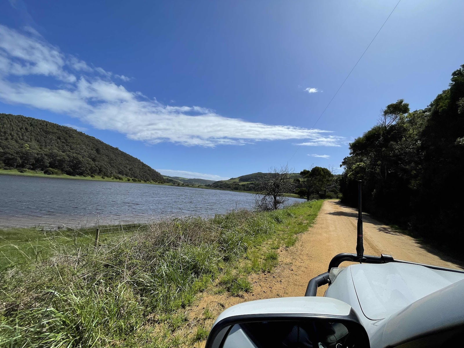
After leaving Wreck beach we decided to return to our campsite along the old ocean road

A very pretty drive


Following the course of the Gellibrand River

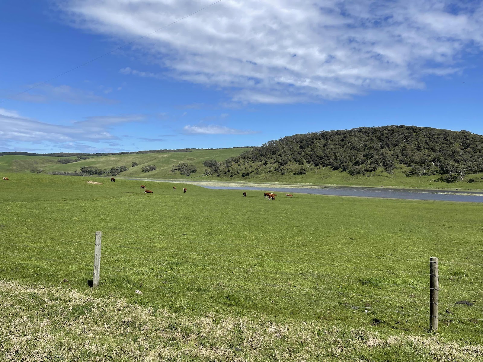
Past areas where it had caused lagoons


And areas where farmland had been flooded


The spot had been tracking as we were travelling along this road


The road eventually came out at Princetown


So not far to drive back to our campsite
My alltrails tracking of Wreck beach did not show anything dramatic but I have incorporated pictures into the app
After leaving Wreck beach we decided to return to our campsite along the old ocean road
A very pretty drive
Following the course of the Gellibrand River
Past areas where it had caused lagoons
And areas where farmland had been flooded
The spot had been tracking as we were travelling along this road
The road eventually came out at Princetown
So not far to drive back to our campsite

After a late lunch and a bit of a rest we decided to go and check out Princetown beach

We were hoping to drive down to it


But the track looked a bit churned up and was quite sandy so we decided not to bother as it would have meant letting the tyres down

So we walked down to the beach instead


A few different pretty wildflowers here


As we came out from walking through the bush the walk ended up at the estuary of the Gellibrand River


Very cold and windy down at the beach and the water was very brown obviously from all the agriculture occurring up River

Noticed these wind turbines up on the hills on our walk back

More interesting plants


When we got back to the car park we decided to drive on past the campsite over the Gellibrand River to the little picnic area the other side of the bridge

From there we walked over the boardwalk through the wetlands towards the little town of Princetown


Stopped and read the signs on the side of the pathway up into the town


Spent some time looking around the town at the sad closed buildings.
Even the post office was closed!!


and sadly the pub

We did walk further down past some houses where there are obviously some people living there before heading back down to the campsite

The HEMA tracking for the day

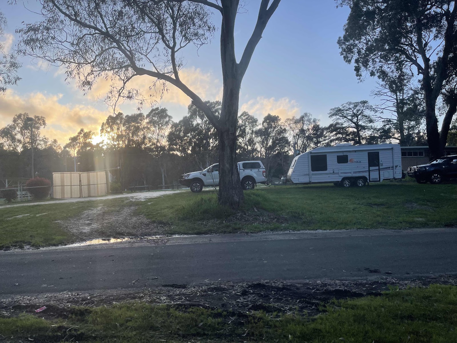
Lots of large kangaroos hopping around the campsite to welcome us back

Even had a reasonable sunset tonight


Bill cooked up a tikka masala chicken curry for dinner
We went to bed reasonably early tonight

Comments
Post a Comment