Day 24 Mt William, Halls Gap and Plantation Camp Ground

Had a good night camping at this location
Had a good night sleep
Thank goodness woke up feeling okay today as I was not feeling too crash hot yesterday
Headed out of the camp spot reasonably early as we had not unhooked the van.
Bill noticed this memorial as we drove out of the campground

Turning out of the campground

We crossed the Wannon River


And turned towards Halls Gap


With views of the mountains ahead of us covered in cloud

Came to Jimmys Creek Campground

And drove in and around it to check it out only out of curiosity as we were not planning to stay there the night


Out on the road again heading for Halls Gap


Passing a few landmarks


Before we reached the turn off to Mount William

The road up was initially quite clear


But the higher up we drove the mistier it got

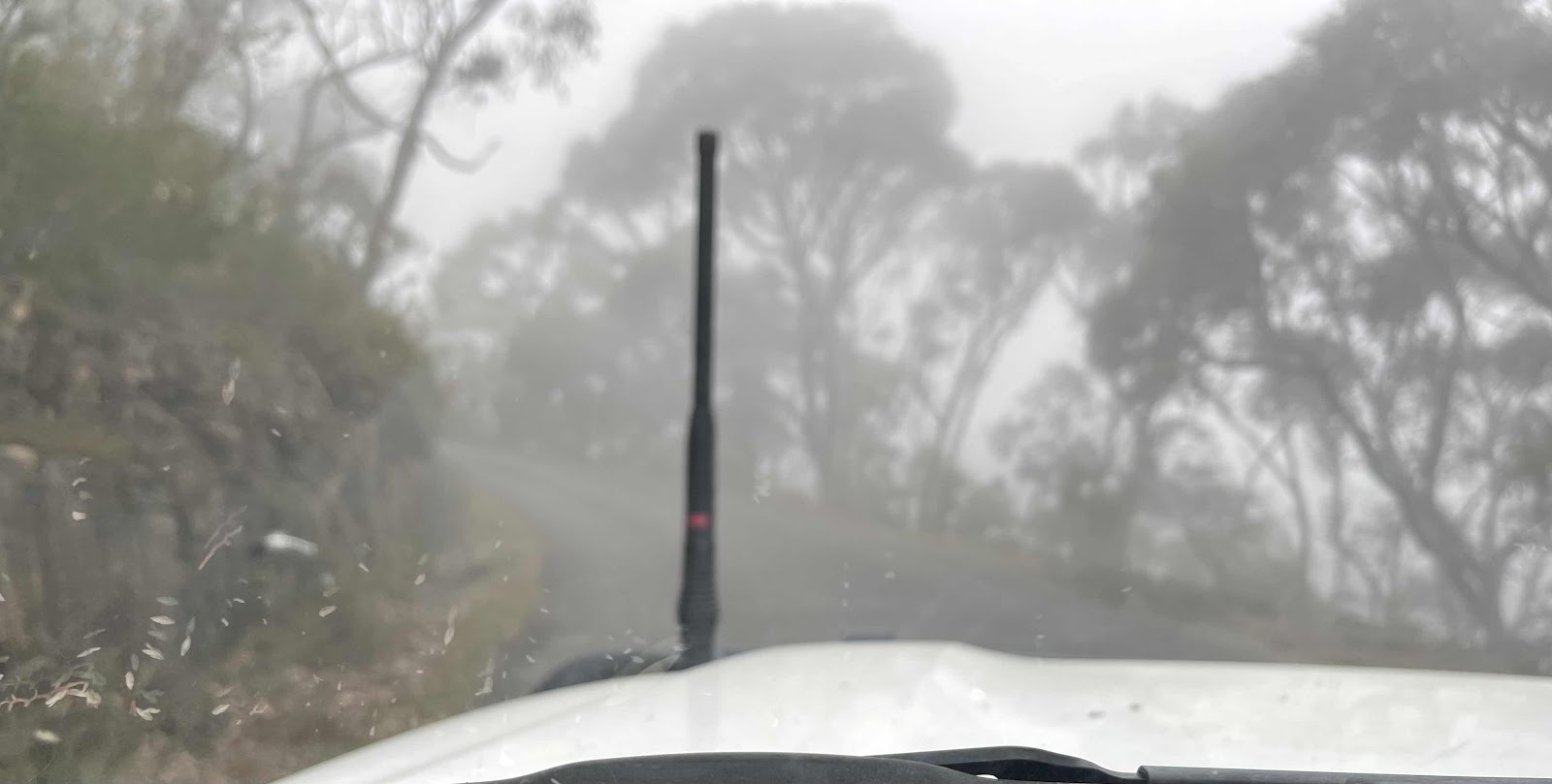


Once we reached the car park we realised that we would need to leave the van and walk up to the summit

Lots of information about the mountain and the area at the car park


Had to take a selfie of me all covered up ready for the hike up in the bad weather

Clear signage to show the way the distance and the time that it should take

And plenty of warnings

Off we set, up the steep track with an interesting cliff face beside us

Found this one seat on the way up to rest at

I used my walking sticks to make it easier to get up the steep slope


Higher up we went the more dense was the mist


We eventually reached the end of the road and the start of the short track up to the communication towers


So clouded in mist we couldn’t even see the top


Suddenly the sun came out for a very brief period

Just in time for me to take this photo of it as a halo behind part of the communication tower

We walked around the perimeter of the tower

And plenty of warnings
Off we set, up the steep track with an interesting cliff face beside us
Found this one seat on the way up to rest at
I used my walking sticks to make it easier to get up the steep slope
Higher up we went the more dense was the mist
We eventually reached the end of the road and the start of the short track up to the communication towers
So clouded in mist we couldn’t even see the top
Suddenly the sun came out for a very brief period
Just in time for me to take this photo of it as a halo behind part of the communication tower
We walked around the perimeter of the tower
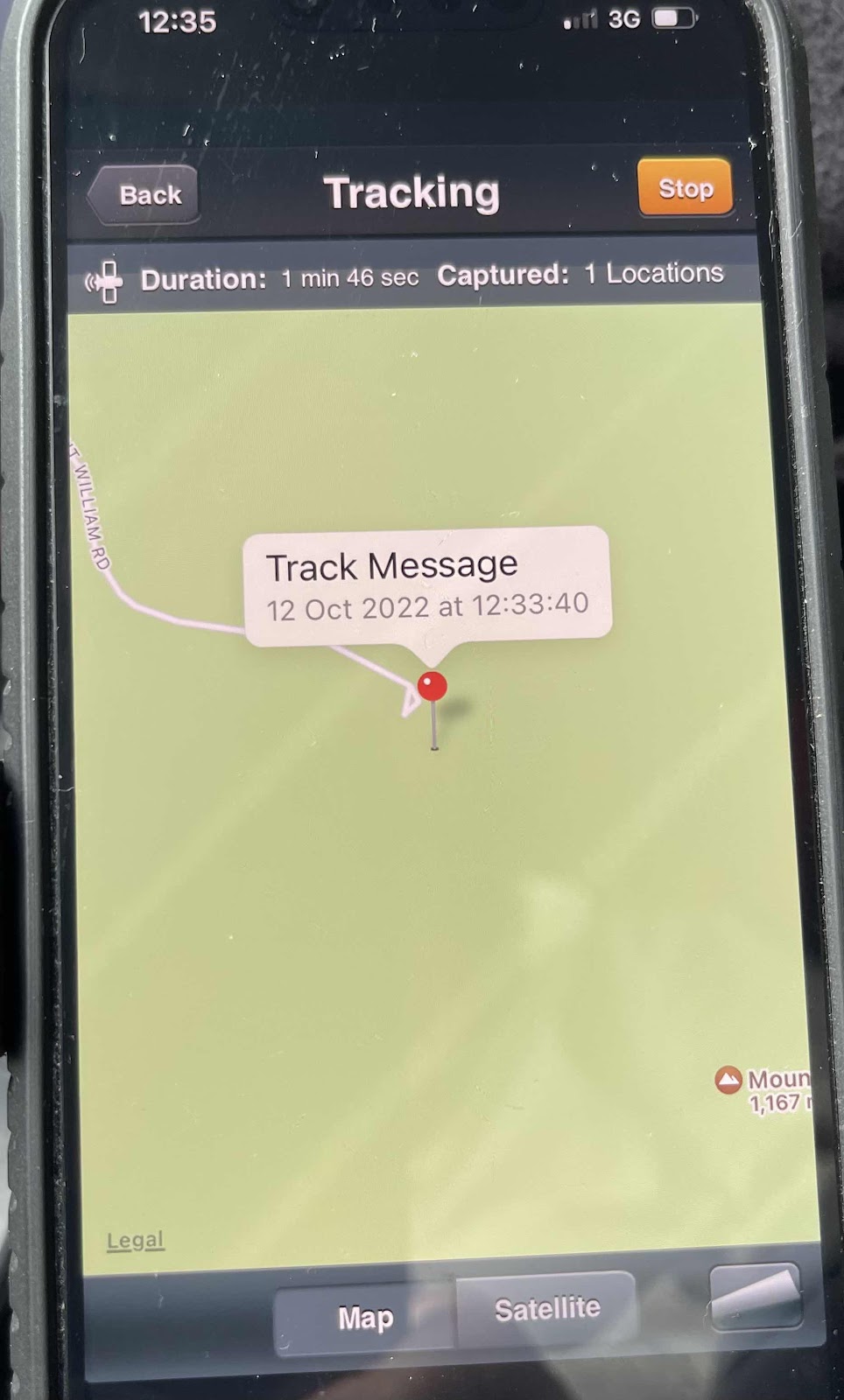
Bill sat and activated the spot so that it did send a track message at this point

I recorded our tracking on AllTrails


I took the opportunity of having a signal to ring Mouche to wish her a happy birthday


I then pretended to point out to Bill the absolutely amazing view that actually didn’t exist because we could hardly see beyond the end of our noses
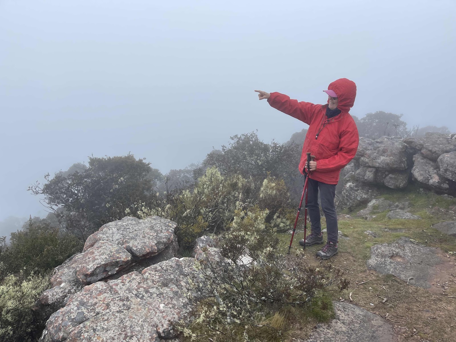

We just had to imagine the view or maybe look at other peoples pictures of what they saw when they reached the summit


We walked around to the trig point


Took photos of the communication tower just disappearing into the ether

Had to have a photo in front of all these signs

Loved the falling ice one

On the way down noticed lots of bushes in flower

And water droplets falling off the branches from the wet atmosphere

Past this gorgeous coloured rock face

And back to the car park and our van
I then pretended to point out to Bill the absolutely amazing view that actually didn’t exist because we could hardly see beyond the end of our noses
We just had to imagine the view or maybe look at other peoples pictures of what they saw when they reached the summit
We walked around to the trig point
Took photos of the communication tower just disappearing into the ether
Had to have a photo in front of all these signs
Loved the falling ice one
On the way down noticed lots of bushes in flower
And water droplets falling off the branches from the wet atmosphere
Past this gorgeous coloured rock face
And back to the car park and our van
There was no one else around whilst we were there during the walk or when we came back
We were the only nuts to attempt to climb this on such a horrible day, weather wise. Having said that it was a fabulous experience. Lucky to be alive to be fit and well and able to go on such an adventure

My all trails map show that we went up and back down again and walked around the summit

Bill made sure that the SPOT put another track back at the car park
Back out on the main road towards Halls Gap


Passing several landmarks on the way


Stopped off at Lake Bellfield
Back out on the main road towards Halls Gap
Passing several landmarks on the way
Stopped off at Lake Bellfield
I don’t think I would like to swim here


Took photos of the dam wall

Had no idea this lake was actually a damned waterway and that it was a water supply dam for the area


Drove down below the dam wall


And on to Halls Gap

Past the Brambuk cultural Centre which is apparently closed but according to the people at the information centre the National Park centre is not closed

Past this pub that we might attend at some point

And into Halls Gap where we drove around trying to find parking big enough for the car and the van

Was impressed by this colourful art wall that we walked past and it’s story

Took this photo of the beehive on one of the panels

And then a photo of the whole wall from across the road

The reason for stopping in Halls Gap was to call-in at the information centre to acquire useful information for the rest of our stay in the Grampians

Tim at information centre was extremely helpful and used a yellow highlighter to mark and explain to us places of interest
Took photos of the dam wall
Had no idea this lake was actually a damned waterway and that it was a water supply dam for the area
Drove down below the dam wall
And on to Halls Gap
Past the Brambuk cultural Centre which is apparently closed but according to the people at the information centre the National Park centre is not closed
Past this pub that we might attend at some point
And into Halls Gap where we drove around trying to find parking big enough for the car and the van
Was impressed by this colourful art wall that we walked past and it’s story
Took this photo of the beehive on one of the panels
And then a photo of the whole wall from across the road
The reason for stopping in Halls Gap was to call-in at the information centre to acquire useful information for the rest of our stay in the Grampians
Tim at information centre was extremely helpful and used a yellow highlighter to mark and explain to us places of interest

We had heard that there was going to be rain this afternoon and a bad weather event tomorrow
I noticed this sign on the counter in the information centre with the weather forecast for today and the next few days so I took a photo of it

The person in the information centre gave us direction to where we should be able to find something to eat so we stopped off here and bought some rolls and some coffee


On walking back to the car Bill took this photo of this mural

Driving north out from Halls Gap


Noticing the bad weather closing in over the hills

We took the turn off to Mount zero Road

Which ended up being a gravel road


But was in very good condition


 Turned off at the plantation campsite sign


And pulled up at the entrance and walked around the campsite looking at possible sites to camp for the night
Came across this matrix parked in one of the sites

When we got back to our van there were two other cars towing vans turning in to the area that we had eventually decided we would camp in so we had to quickly make a decision as to where we would put our van. possibly not the best spot but okay

This HEMA map shows where we travelled today
When we got back to our van there were two other cars towing vans turning in to the area that we had eventually decided we would camp in so we had to quickly make a decision as to where we would put our van. possibly not the best spot but okay
This HEMA map shows where we travelled today

And this screenshot of BOM shows the rain around

We escaped the worst but still got a fair bit of rain that Bill has been catching with the rain catcher attached to the awning


Comments
Post a Comment