Day 39 continuing on the Eyre Peninsula
After we had packed up and before we left the park, we made the most of what was available to us at the park - emptied our black water at the dump pump and topped up our water tanks.
We had certainly made the most of our two day stay in Coffin Bay with the van at this caravan park even though we were in an unpowered site we still had access to all the facilities - laundry to do all our washing, bedding etc and we used the kitchen for washing up and the power there for boiling the jug etc.

But now time to move on going past the lovely oyster shack

And on the road out

Taking the shorter gravel road to join the Flinders Highway

With ocean views on the way


And passing places that we did not visit
Farm beach was one of the places that had been recommended as a good campsite but we were travelling further than that today

Views of Mount Dutton

Photos here of the changing landscape some of it with flat plains others with a lot of vegetation especially

With the roadside lined with trees


We came across this sign


So turned off to check it out

We spent quite awhile there


Walking around the cliff top


Making sure we did not walk too close to the fragile edges

Lots of interesting plants up on the cliff tops


Stunning views and weren’t we lucky that the sun had come out


We stopped off to check out this historic eating house at Lake Hamilton


Tried to take a photo of this dry stone wall as there were a lot of rocks in this area and there were quite a few of these dry stone walls

Getting peckish we noticed that WikiCamps had Sheringa Roadhouse flagged a little bit further on the highway

So we pulled up

Wow what a delightfully fun interesting place

In spite of some of the comments that we read on WikiCamps where it was referred to as eerie and spooky in a derogatory way we found it enjoyable and fascinating
Views of Mount Dutton
Photos here of the changing landscape some of it with flat plains others with a lot of vegetation especially
With the roadside lined with trees
We came across this sign
So turned off to check it out
We spent quite awhile there
Walking around the cliff top
Making sure we did not walk too close to the fragile edges
Lots of interesting plants up on the cliff tops
Stunning views and weren’t we lucky that the sun had come out
We stopped off to check out this historic eating house at Lake Hamilton
Tried to take a photo of this dry stone wall as there were a lot of rocks in this area and there were quite a few of these dry stone walls
Getting peckish we noticed that WikiCamps had Sheringa Roadhouse flagged a little bit further on the highway
So we pulled up
Wow what a delightfully fun interesting place
In spite of some of the comments that we read on WikiCamps where it was referred to as eerie and spooky in a derogatory way we found it enjoyable and fascinating
Even so, it was the only place along this section of the highway where there was even a dwelling on the side of the road


We ordered cappuccinos and a couple of burgers that were delicious and we ate them out here looking out at the bushes


We had read about Sheringa beach and the fact that there were lots of nice campsites along the section but we decided to push on as we knew that we were going to pull in at other beaches further on


The next place on the highway that we had read about was locks well it sounded interesting so we thought we would go and check it out


Turned out that we couldn’t take the van down to the lower car park so we parked on the top car park

Next to the sheep


We started to walk down the road

But then I noticed some big steps to the left of the road

So we went back up to the car park and discovered a track starting from there

The track was mostly hidden by masses of this gorgeous fluffy headed grass

The track wound its way down the hill side to a look out


There was a toilet at the lower car park - loved this sign denoting the ladies toilet

Views from the top down to the beach


And across to the nearly 300 steps down

Which Bill decided to run down


I stayed at the top and watched

You can barely see Bill down at the bottom in this photo

Bill took these photos from down the bottom


Before heading back up


Flies kept getting in under my glasses so I ended up wrapping my rain jacket around my face to keep them away

Even though the sign at the top said the well was still there we never found it
We ordered cappuccinos and a couple of burgers that were delicious and we ate them out here looking out at the bushes
We had read about Sheringa beach and the fact that there were lots of nice campsites along the section but we decided to push on as we knew that we were going to pull in at other beaches further on
The next place on the highway that we had read about was locks well it sounded interesting so we thought we would go and check it out
Turned out that we couldn’t take the van down to the lower car park so we parked on the top car park
Next to the sheep
We started to walk down the road
But then I noticed some big steps to the left of the road
So we went back up to the car park and discovered a track starting from there
The track was mostly hidden by masses of this gorgeous fluffy headed grass
The track wound its way down the hill side to a look out
There was a toilet at the lower car park - loved this sign denoting the ladies toilet
Views from the top down to the beach
And across to the nearly 300 steps down
Which Bill decided to run down
I stayed at the top and watched
You can barely see Bill down at the bottom in this photo
Bill took these photos from down the bottom
Before heading back up
Flies kept getting in under my glasses so I ended up wrapping my rain jacket around my face to keep them away
Even though the sign at the top said the well was still there we never found it
Took a photo of the spot image

And also did a all trails tracking that I posted on Facebook
And also did a all trails tracking that I posted on Facebook

Back on the highway we headed for Elliston


Where we came across this beautiful painted community building - every side had a mural on it


We drove around to the foreshore to find the historic jetty


This information was near the jetty

With a cart and this monument

Quite a nice beach here

Where Bill went down to take photos of the jetty


And me on it
The reason he took the photo from below was to show the unusual steel pylons


Interesting history about the jetty and the trade at the time

Next we drove down the great ocean tourist Drive and went along the cliff Drive where there were lots of sculptures


And stunning views

We came across a few weird looking things that did not seem to be listed on the pamphlet that I had picked up at the information place but took photos of them anyway


It took us quite awhile going along the drive as we did stop to look at each sculpture and read about it from the pamphlet

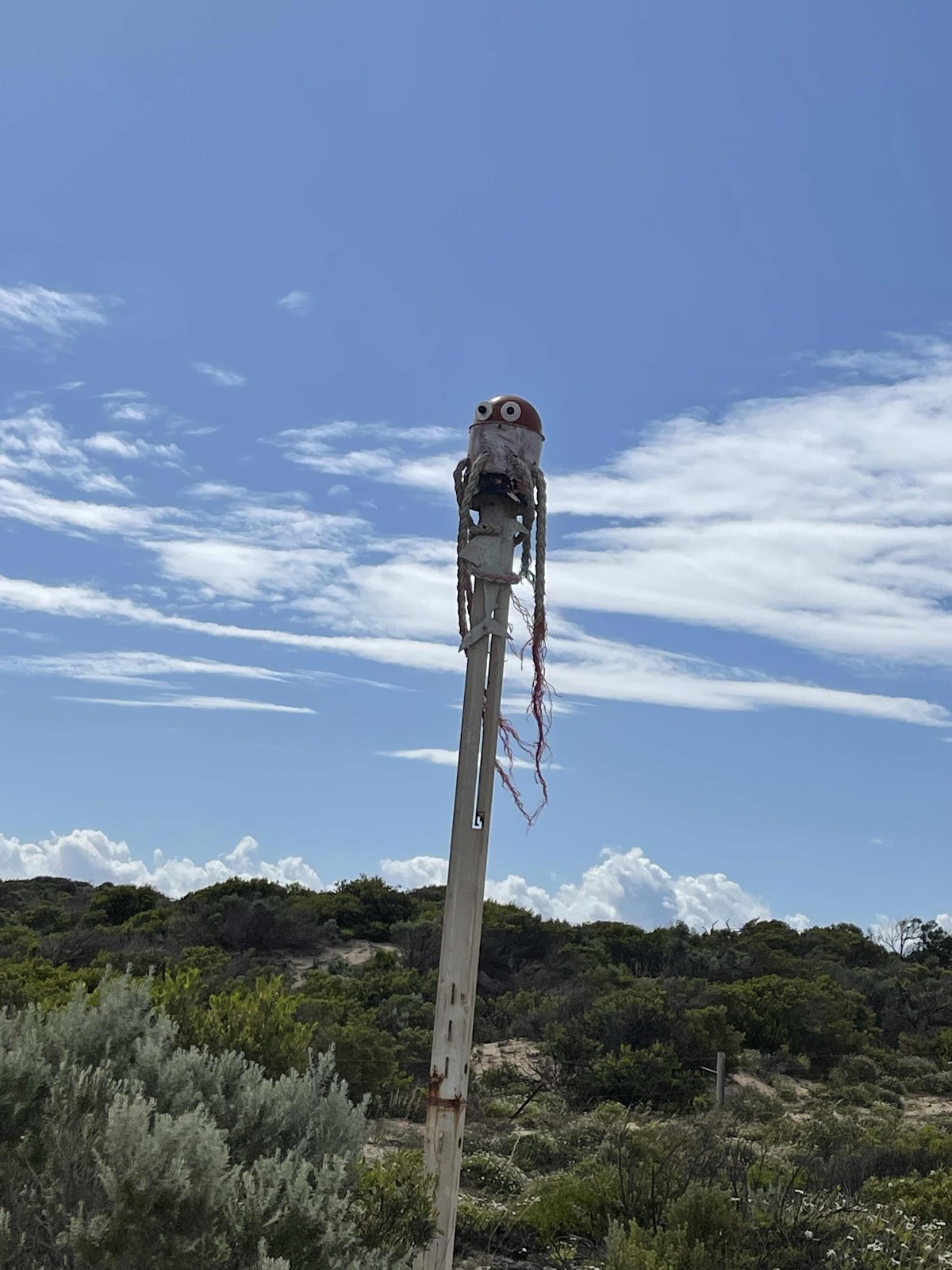
Then we came to what was obviously one of the sculptures of the cliff Drive

These two faces were at the entrance through a gate Although a description of them was not in the pamphlet
Interesting history about the jetty and the trade at the time
Next we drove down the great ocean tourist Drive and went along the cliff Drive where there were lots of sculptures
And stunning views
We came across a few weird looking things that did not seem to be listed on the pamphlet that I had picked up at the information place but took photos of them anyway
It took us quite awhile going along the drive as we did stop to look at each sculpture and read about it from the pamphlet
Then we came to what was obviously one of the sculptures of the cliff Drive
These two faces were at the entrance through a gate Although a description of them was not in the pamphlet
Elliston is described as a small remote township of 300 people situated on the great Australian Bight it is a town of farming abalone fishing surfing and tourism. A land with massive cliffs facing the immense power of the southern ocean. The first instalment of the sculptures on the cliff was in 2002 in the following years there has been some erosion by the elements and new sculptures have been added. The sculptures that have been done by local artists are on display along the drive


This one was my favourite and was called the ospreys nest


Drive took us past Salmon point

Where there was this interesting information


This sculpture didn’t appear to have a description but very nice all the same with the sea as the backdrop

This one is called the salmon pole

Took photos of these fascinating plants just growing out of the sandstone

This one is called Argo
The delicate egg taste of the paper nautilus Argonauta Argo is a treasure for the artist who would love to find on an empty beach someday
It is also named after the ship Argo of ancient legend
And is made of Mount Gambier Dolomite

This sculpture is called Mara in Latvian tradition Mara is considered the mother of the earth, the provider of water and milk a protector of livestock and was thought to be present at birth and deaths


This one called The Passage is sculpted in Wudinna granite engraved images of grain and sheep representing the farming industry and curved horizontal lines for the sea and fish. The upward pointing pieces reach for the sun profile


gorgeous views as we drive along the cliff top scenic route

The Dolphin has been made out of wire to form the main shape with twigs and small branches covering the wire


The Headland

We discovered a swarm of bees that had made a little hive inside the large head


Threatening looking storm clouds ahead


Germination
This sculpture is based on an organic form that is found throughout nature reminiscent of an egg or a seed, a pebble or a falling ranger drop.
The sprouting leaves are a universal motif in nature suggesting notions of regrowth nurturing and togetherness relevant to the themes in these recent times


Leafy Sea Dragon
Leafy Sea Dragon
Made from recycled farm scrap metal and it’s supposed to turn into the wind but the bearing on it has rusted so it no longer turns


Found this beautiful mosaic tiled table in the nearby shelter


More interesting little plants just sprouting out of the sandstone

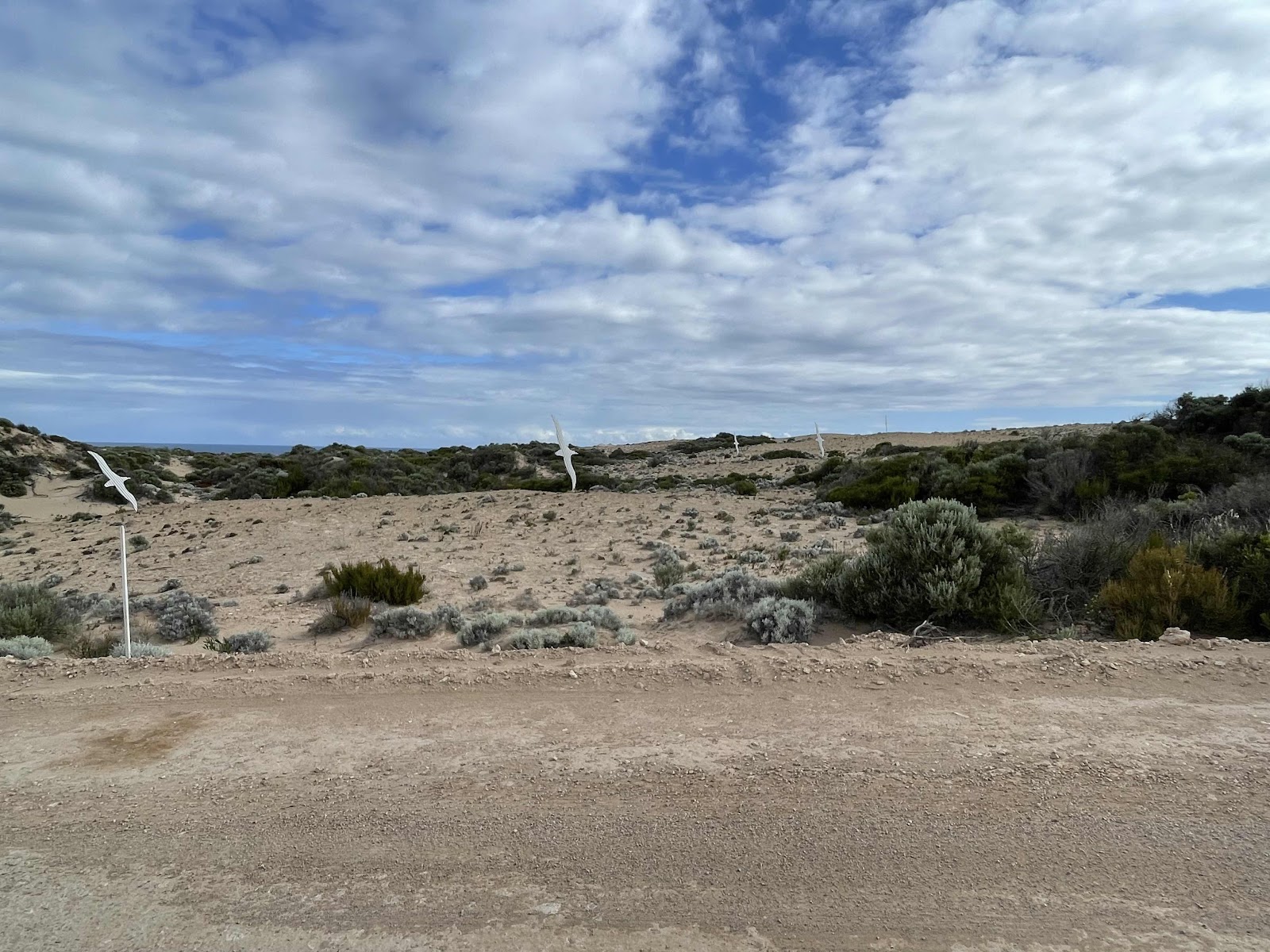
There were several of these on the hillside called the Ocean Wanderer


This one is called Thongz
Found this beautiful mosaic tiled table in the nearby shelter
More interesting little plants just sprouting out of the sandstone
There were several of these on the hillside called the Ocean Wanderer
This one is called Thongz
Named after thongs that are easily associated with the beach and coastline

Coming back out from the scenic drive we headed back onto Flinders Highway West

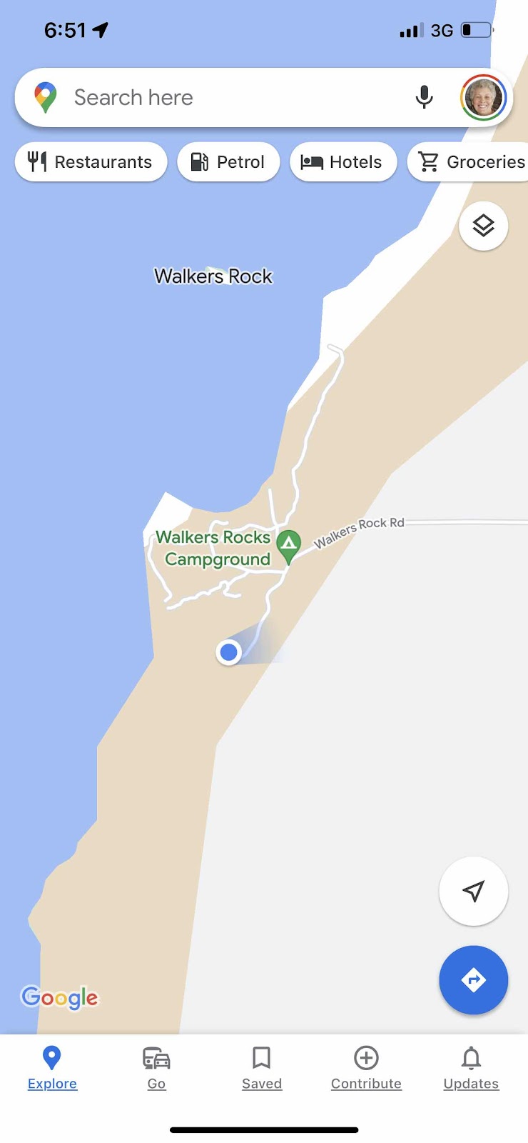
To walkers rock a camping area that had been recommended to us a few times


We hadn’t booked our campsite because we wanted to wait to see where we were going to camp first

This was all that was at the entrance to show you the campsites but there were no names next to the campsites and no clear direction as to where they were. We logged onto the website and it listed three different campsites at Walker’s rocks but no clear indication of what each one was
Coming back out from the scenic drive we headed back onto Flinders Highway West
To walkers rock a camping area that had been recommended to us a few times
We hadn’t booked our campsite because we wanted to wait to see where we were going to camp first
This was all that was at the entrance to show you the campsites but there were no names next to the campsites and no clear direction as to where they were. We logged onto the website and it listed three different campsites at Walker’s rocks but no clear indication of what each one was

So we walked around the site checking it all out


This blue stuff had obviously been sprayed on areas where sand was exposed to retain the sand on the area

Seeing as we had decided we would camp here tonight as we were sure we would find somewhere nice we stopped all the tracking


After finding a really nice spot in a little turnaround in the bushes we set up camp there


And then proceeded to login and pay for a site at one of the walkers rocks camp sites


We then walked down to the beach to check it out with a view to sitting and enjoying a sunset down there


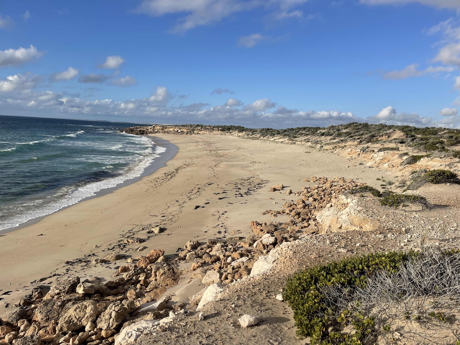


The beach where we walk down to

And our campsite location
We went down onto the beach first with our chairs and drinks and nibbles but it was a little too windy so we went back onto the cliff top and sat behind the shelter of a bush


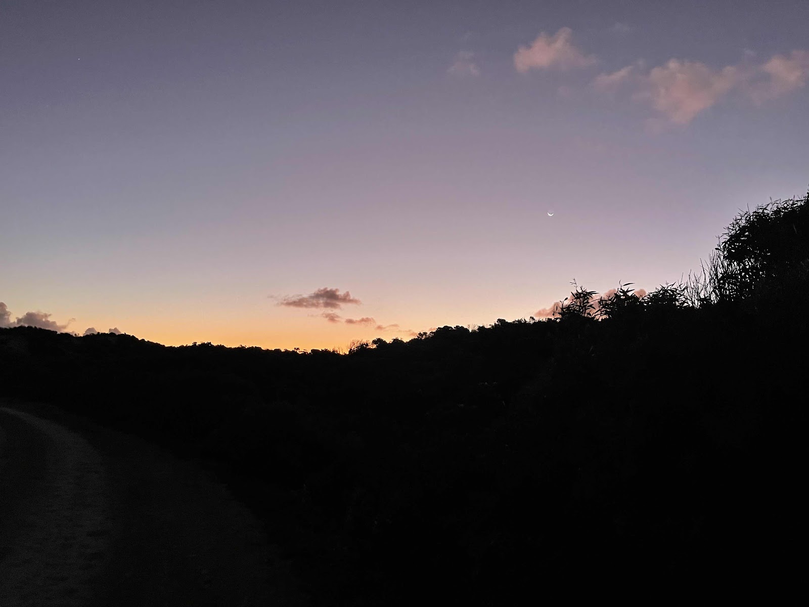
And sat and enjoyed a beautiful sunset over the ocean


Except it clouded over just as the sun was going down over the horizon


Did leave pretty colours on the clouds though


Back to the van for dinner


And more photos of the pretty sky with the moon showing


Comments
Post a Comment